Expert Drone Services for Stunning Results
High-quality aerial photography, video, mapping, and inspections to boost your business.
FAA certified & insured
Save 30% on inspections
Faster, safer site mapping


3D Modeling & Mapping*

We create detailed 3D models and maps using drone-based photogrammetry and LiDAR scanning. These models are used for construction planning, urban development, asset inspections, and digital twins*.
Key Features
-
High-Resolution Terrain & Structure Mapping – Useful for architectural and engineering analysis
-
CAD & BIM Compatibility – Models can be integrated into existing workflows
-
Real-Time Progress Monitoring – Track and document site changes over time
-
Interactive Virtual Walkthroughs – Presentations for stakeholders and clients
Pricing
-
Small Area Mapping (up to 5 acres) – Starting at $1,000 per scan
-
Medium Area Mapping (5 – 15 acres) – Starting at $2,000 per scan
-
Large Area Mapping (15+ acres) – Custom pricing based on project scope
Industry-Specific Drone Operations*
We offer custom drone solutions for construction, real estate, infrastructure monitoring, and precision agriculture*.
Key Features
-
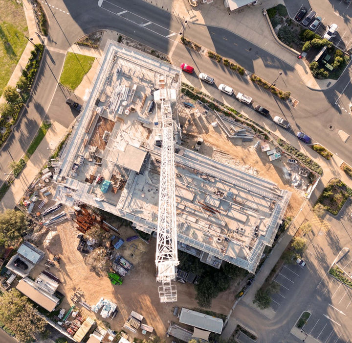
Construction Progress Tracking – 3D site surveys and automated monitoring
-
Real Estate Showcasing – High-resolution property listings and FPV flyovers
-
Industrial Inspections & Monitoring – Thermal imaging and asset assessments
-
Agricultural Crop Health & Irrigation Analysis – Precision farming with multispectral imaging
Pricing
-
Basic Aerial Site Survey – Starting at $499 per session
-
Construction Progress Tracking – Starting at $1,200 per project
-
Agricultural Drone Mapping – Starting at $999 per scan
FPV Aerial Videos

Our FPV drone services provide fast, dynamic aerial video for marketing, tourism, real estate, and commercial branding. These drones navigate through indoor and outdoor spaces, capturing continuous, first-person perspective footage.
Key Features
-
Agile, High-Speed Drone Maneuvers – Ideal for fly-throughs of large properties and venues
-
Cinematic Transitions – Professional editing for high-quality video content
-
Versatile Applications – Hotels, resorts, showrooms, and industrial facilities
-
Brand Customization – Integrated branding for corporate presentations
Pricing
-
Basic FPV Video (up to 2 minutes) – Starting at $350 per session
-
Advanced FPV Package (3–5 minutes) – Starting at $700 per session
Video Memorandum

A Video Memorandum is a professional video report combining aerial and ground footage. It is designed for investor presentations, corporate reports, and project documentation, offering clear visual representation of key assets and developments.
Key Features
-
Edited Video Reports – Clear and structured corporate presentations
-
Scripted Voice-Over & On-Screen Data – Detailed explanations and insights
-
Aerial & Ground Footage – Full coverage of real estate, construction, and industrial projects
-
Custom Branding & Graphics – Includes company logos, animations, and key metrics
Pricing
-
Basic Memorandum (2–3 minutes) – Starting at $600
-
Advanced Memorandum (3–5 minutes & graphics) – Starting at $1,000
-
Custom Extended Reports (5–10 minutes, fully produced) – Starting at $1,800
Aerial Photo & Video
We provide high-resolution aerial photography and video for real estate, marketing, construction, and inspections. Our drones capture detailed images and stabilized video, offering a clear perspective of properties and projects.
Key Features
-
4K UHD & HDR Imaging – High-quality images with accurate color and clarity
-
Stabilized Aerial Video – Smooth footage suitable project tracking
-
Aerial Mapping – Capture site overviews for surveying and planning
-
Industry-Specific Customization – Adjusted for real estate, infrastructure, and commercial projects
Pricing
-
Aerial Photography (10–15 images) – Starting at $230 per session
-
Aerial Videography (up to 2 minutes) – Starting at $270 per session
-
Photo & Video Package – Starting at $500 per session
Case Studies
See Our Drone Work in Action

* Disclaimer on Drone Services and Digital Models
Please note that while we provide drone flight services and create digital twin models, we are not a licensed professional firm authorized to certify or affix official stamps to documents. The data and digital models generated are intended solely for demonstration, analysis, and project visualization purposes. They are not suitable for official certifications or legal applications requiring professional accreditation. We do not engage in activities that would necessitate such certifications under California law.


